Das Potenzial von Greenfields freisetzen: Visuelle Darstellungen, die besser kommunizieren
About the Project
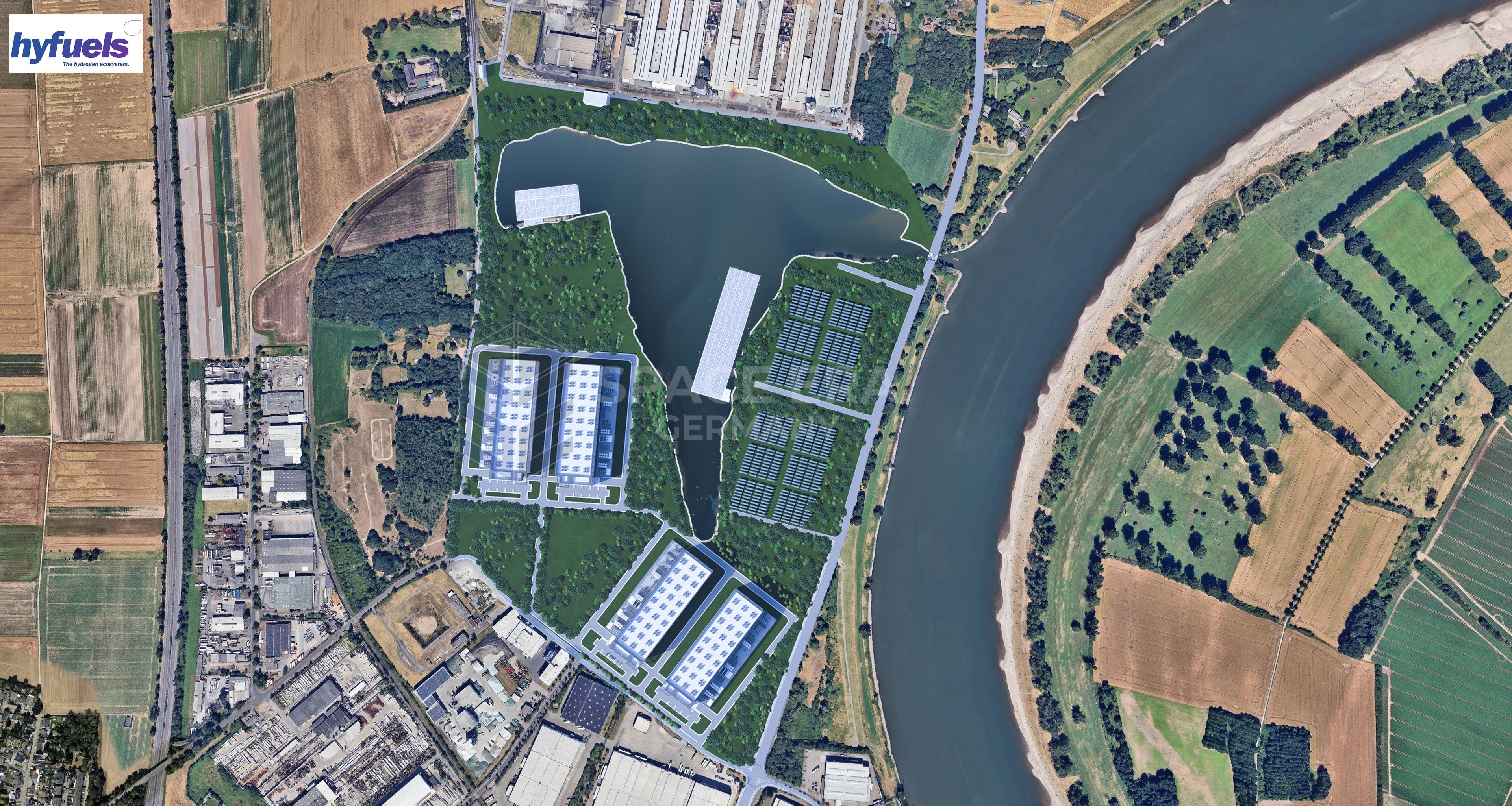
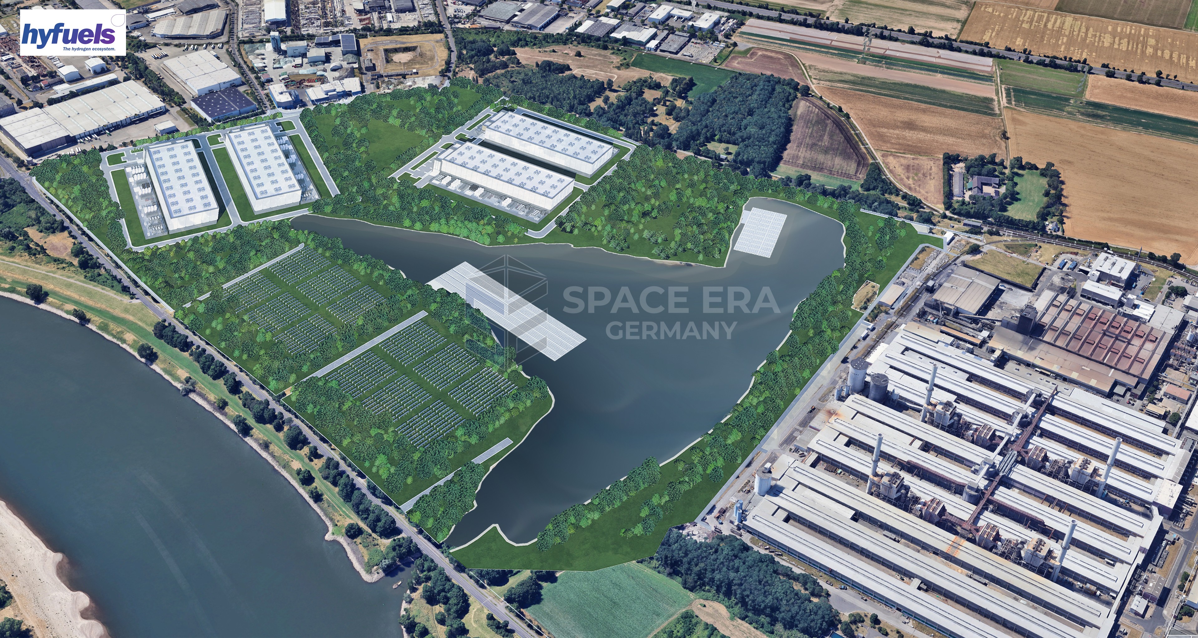
Der Kunde verfügte über ein potenzielles Gelände, auf dem er Solarfarmen sowie Rechenzentren entwickeln wollte. Für die Umsetzung benötigte er jedoch Genehmigungen und finanzielle Unterstützung von den zuständigen Behörden.
OUR TASK
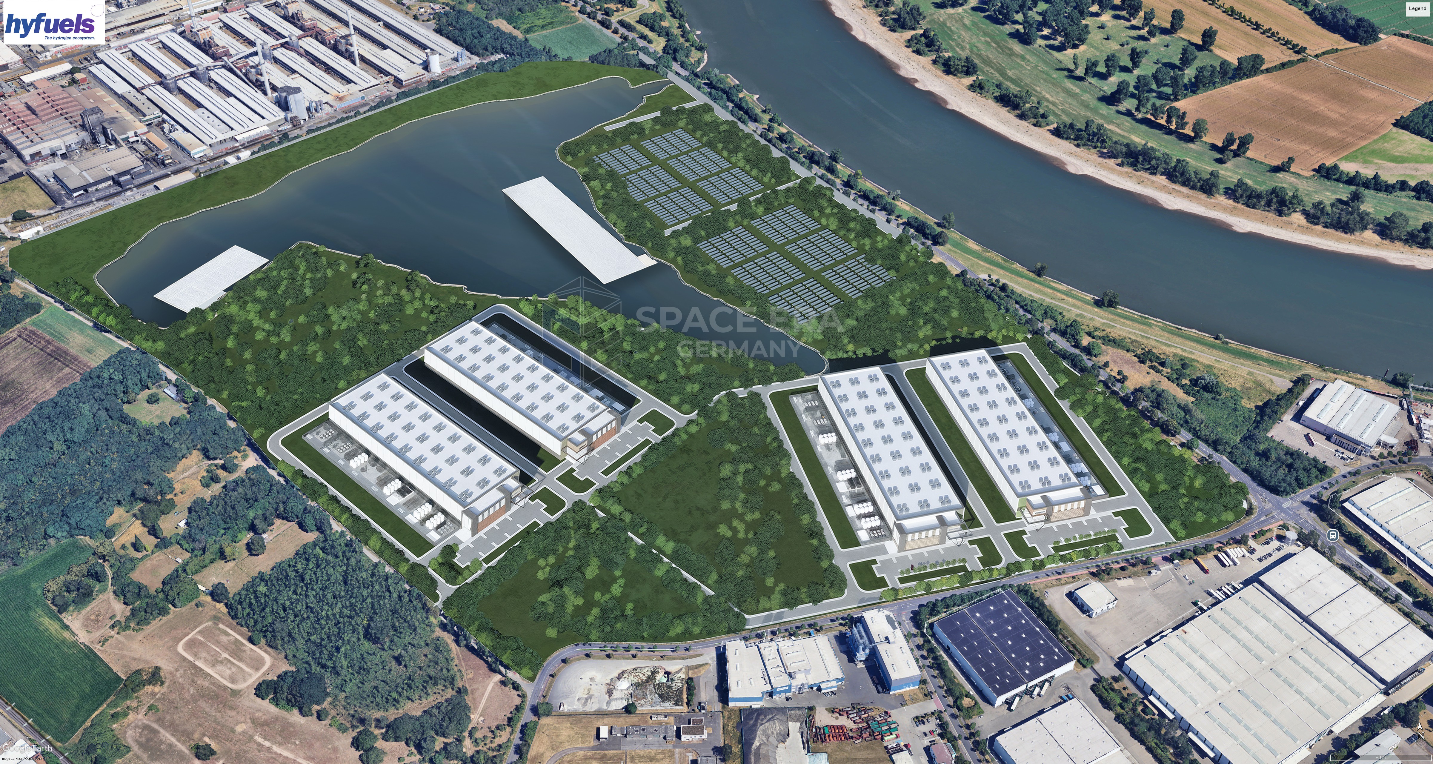
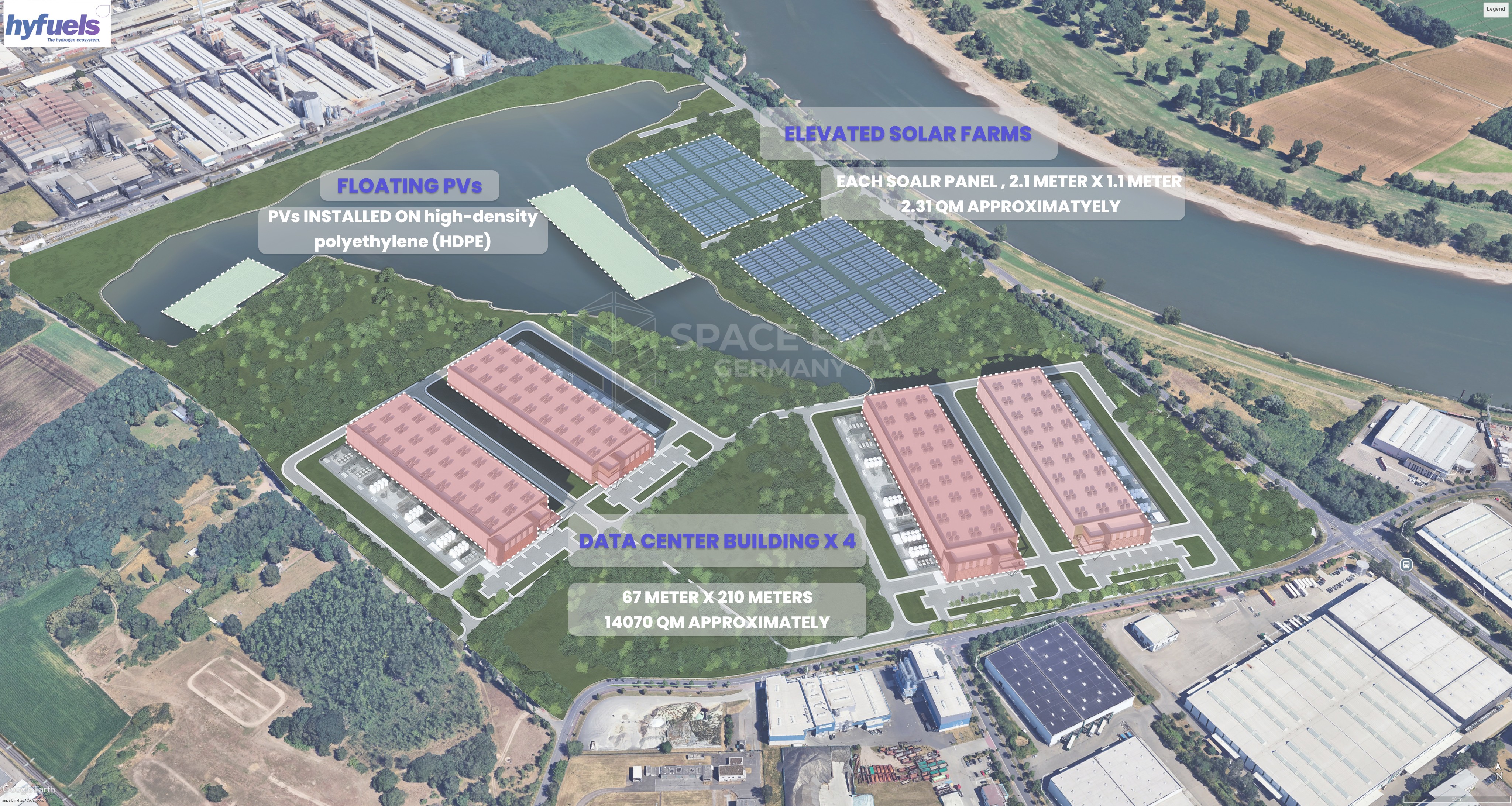
Space Era sollte visuelle Darstellungen entwickeln, die den geplanten Zustand des Geländes mit Rechenzentren und Solarfarmen zeigen.
Transformation
Drag the Slider to Reveal the Magic!
our sOLUTION
Space Era nutzte Standardgrößen für Rechenzentren, identifizierte geeignete Standorte und ermittelte die optimale Anzahl und Platzierung der Rechenzentren sowie der Solarfarmen – sowohl auf dem Land als auch auf dem See, der sich auf dem Gelände befindet. Diese Elemente wurden in einem 3D-Modell platziert. Anschließend wurde das Modell mit Satellitenbildern von Google Earth kombiniert, um eine realitätsnahe Visualisierung des fertig entwickelten Geländes zu ermöglichen.
OUR RESULT
Die von Space Era entwickelten Visualisierungen halfen den Stakeholdern, das Potenzial des Geländes sowie die Veränderungen der Landschaft und Topografie besser zu verstehen. Der Kunde konnte seine Vision überzeugender vermitteln und dadurch leichter Finanzmittel einwerben und Genehmigungen einholen.